|
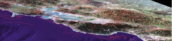
Geographical Information System by Saurabh Singh * Part - VII Three-dimensional GIS: To more realistically analyze the effect of the Earth's terrain, we use three-dimensional models within a GIS. A GIS can display the Earth in realistic, three-dimensional perspective views and animations that convey information more effectively and to wider audiences than traditional, two-dimensional maps.
The old adage "better information leads to better decisions" is as true for GIS as it is for other information systems. A GIS, however, is not an automated decision making system, but is a tool to query, analyze, and map data in support of the decision-making process. GIS technology has been used to assist in tasks such as presenting information at planning inquiries, helping resolve territorial disputes, and setting pylons in such a way as to minimize visual intrusion. Maps have traditionally been used to explore the Earth. GIS technology has enhanced the efficiency and analytical power of traditional cartography. As the scientific community recognizes the environmental consequences of human activity, Map and satellite information sources can be combined in models that simulate the interactions of complex natural systems. Through a process known as visualization, a GIS can be used to produce images and not just maps, but drawings, animations, and other cartographic products. These images allow researchers to view their subjects in ways that they never could before. The images often are helpful in conveying the technical concepts of a GIS to nonscientists. * Contributed by - |